USGS Waste Water Pollutant Tracking Study, 2005

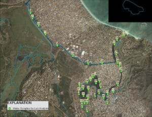
This 2005 study was commissioned by the Hawaii DOH to determine if pollutant loads in the Kaelepulu Estuary could be linked to human sewage sources – either from leaky sewers or from cesspools. USGS scientists sampled 41 locations in the estuary and tested these samples for 87 sewage indicator pollutants. Only one pollutant, caffeine, was measured at above laboratory detection limits at only 3 of the 41 sites. Two of these sites were adjacent to coffee shops. Human sewage does not appear to be a significant pollutant source to the Kaelepulu estuary.
 TMDL Scoping Report, 2005
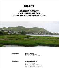
The purpose of a Total Maximum Daily Load scoping report is to define the need for the pollutant study, identify the pollutants of concern, review existing data, and identify potential sampling locations and a method to be used to assess the magnitude of the problem. This study was commissioned by the State DOH for a University of Hawaii researcher, Dr. Roger Babcock, who produced the report in 2004.
TMDL Draft Sample and Analyses Plan, 2005
University of Hawaii researcher, Dr. Roger Babcock, was contracted by the State DOH to produce a sample and analyses plan. The purpose of the plan is to guide field work in an efficient manner so that the results would logically flow into calculation of the total pollutant load to Kaelepulu and meet all data quality control criteria required of the report. The plan is devised to provide the water quality, hydrologic, and meteorologic data necessary to calibrate a watershed model needed to establish the TMDLs.
TMDL Sample Site Map and Sample Sites
The final SAP (Babcock, 2009) determined 80 locations within the Kaelepulu pond, stream and wetland system, and 30 inflow sites, where water samples were to be taken. The map and associated photos document the locations of each sample site.
TMDL Water Quality Progress Report, 2011
Dr. Clyde Tamaru from the University of Hawaii collected data on rainfall, hydrology, depth, and water samples (inflow and pond) from 13 field events between June 2009 and June 2010, with an additional storm event sampled in December 2010. Due to health reasons a final report was never completed. An unaltered copy of Tamaru’s water quality data is linked below. A GIS analyses of the total nitrogen and total suspended sediment data from Tamaru’s database was completed in 2013 (Bourke). Graphical summary of the data averaged for each segment of the water system and for the input (City storm drain) sites clearly shows the storm drain system to be the major source of pollutants to the estuary.
- TMDL Progress Report
- TMDL Data (Tamaru, xls)
- GIS Analyses of Total Suspended Sediment TMDL Data
- GIS Analyses of Total Nitrogen TMDL Data
- TMDL Data Summary
TMDL Biological Survey
One of the purposes of the TMDL program is to improve the health of the aquatic ecosystem. To this end it is important to conduct a biological survey of the waterway to establish a baseline of ecosystem health. Dr’s Clyde Tamaru and David Bybee conducted a survey of Kaelepulu and found an abundance of aquatic organisms but a low diversity in the number of species represented. The fish and invertebrate fauna was dominated by alien introduced species, although native species including gobies, mullet, barracuda, and milkfish were also noted to be present. The prevalence of anaerobic mud sediments, particularly in the Kawainui Branch of the system was noted as a characteristic of a degraded habitat.